









18 August (Part 1) - Sidcup. An even bigger mess
Let’s get away from Sikh things for a moment and dive back into the gridlock
imposed on our roads by Bexley Council and Thames Water.
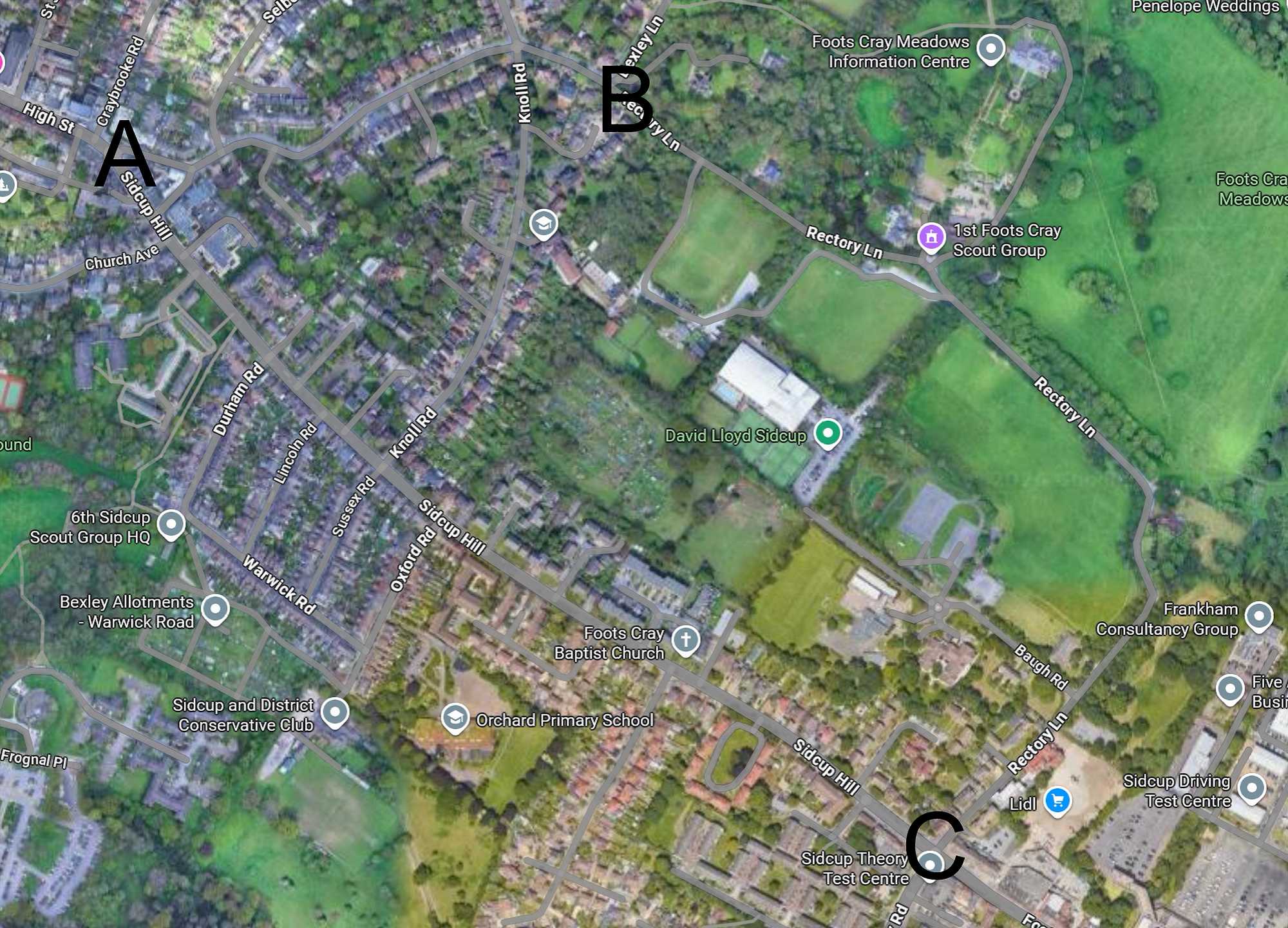
As I made my way through Sidcup at 05:45 yesterday morning a man was unloading
traffic signs from his truck parked where Sidcup High Street becomes Sidcup
Hill. (A on the map below.)
Sure enough, when I returned an hour later there was a road closed sign on the
left turn into Rectory Lane. A. (Not named on Google Maps at this scale.) I therefore continued to Knoll Road to get back
on route. However the actual road closure began at point B, and as I discovered
in the evening, ended at point C.
I have long held the possibly unkind view that the people who put out temporary
road signs are not the sharpest tools in the box and the road closed sign at A
was particularly stupid. No one affected by the closure of the narrow winding
part of Rectory Lane, B to C, would want to turn left at A. They would take the
direct route down Sidcup Hill.
My evening trip to Bromley was made more difficult by the unnecessary closure sign at A because no
one was turning Left which usually creates a useful break in the traffic flow. The various
diversion signs were a nonsense too. No one knows where drivers are trying to
get to once disrupted by unnecessary signs. If I had followed them I might
have ended up back in Bromley.
By the way, when I arrived in Bromley around 6 a.m. it was obvious that it had
been raining there. Puddles everywhere.